On February 4, 2019, DHEC approved SCE&G (now Dominion Energy) to move forward with the permitting process for a Modified Removal Action (MRA) to address tar-like material (TLM) in the Congaree River. This MRA was derived from meetings between SCE&G, DHEC, and primary stakeholders to target areas for removal where TLM is at its thickest and has the greatest potential for human exposure. This MRA acknowledges that some TLM might remain in the riverbed but situated in areas that would pose very little future risk to human exposure.
The proposed MRA consists of two areas. Area 1 is approximately 2.6 acres and has a similar footprint to the original full-scale Phase 1 area. Area 2 is approximately 0.5 acres in size. Assuming successful completion of the MRA as proposed, an estimated 73% of the total TLM is expected to be removed from the Congaree River.
The USACOE Nationwide Permit 38 for the Modified Removal Action was authorized and verified on December 10, 2021. Along with allowing the Modified Removal Action to move forward the USACOE Nationwide Permit required removing the formerly permitted sediment capping project as a permitted alternative. On December 23, 2021, DHEC issued an Authorization to Construct under the General Permit SC-GP-2009-00. This permit provides State authorization for the project to proceed as proposed.
On February 9, 2022, DHEC issued the Action Memorandum for the Congaree River Sediments Site. The Action Memorandum’s purpose is to request and document approval of the proposed removal action and determine that it meets the National Contingency Plan (NCP) Section 300.415(b)(2) criteria for removal actions.
The figure below provides a visual representation of the areas targeted for a modified removal action and their location.
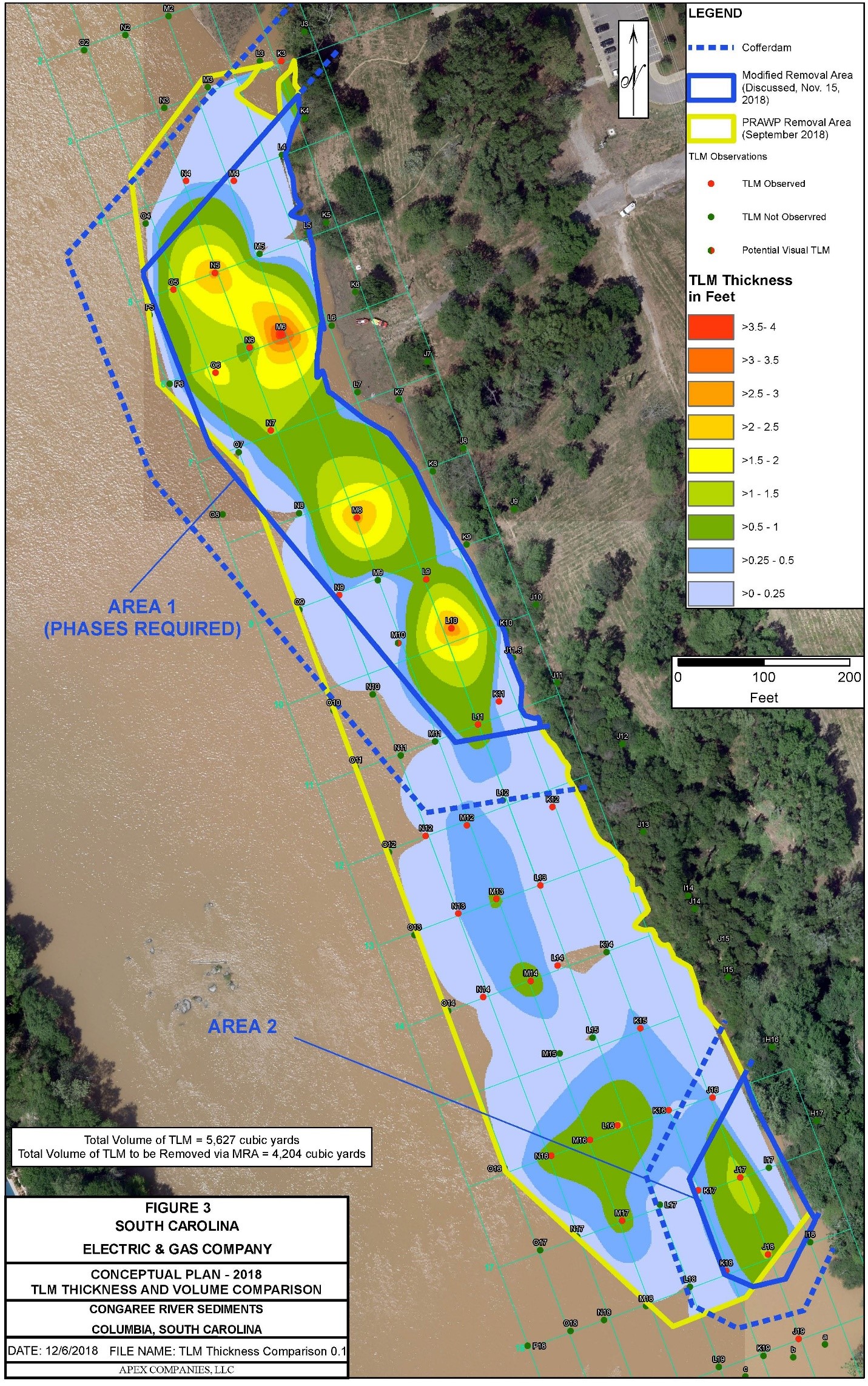
Figure 3 provides an updated depiction of the average TLM thickness with estimated volume, using a similar GIS tool in which the TLM representation extends into the adjacent data point.